View 93 Photos
Solo Hiking the North West Circuit on Stewart Island / Rakiura
In February 2024 I solo hiked the North West Circuit on Stewart Island / Rakiura, New Zealand. It took me five days to complete and I stayed at huts or pitched my tent. The island is known for its wildlife and I managed to see the most wanted bird of New Zealand, the Kiwi!
Hike
Download GPX
Hike
Download GPX
Day 1
I took the first flight of the day and a 9am water taxi to Port William Hut. The reason I skipped this first section (Oban —> Port William) is that it would save me time walking over a boring road and who doesn’t enjoy a nice boat ride!
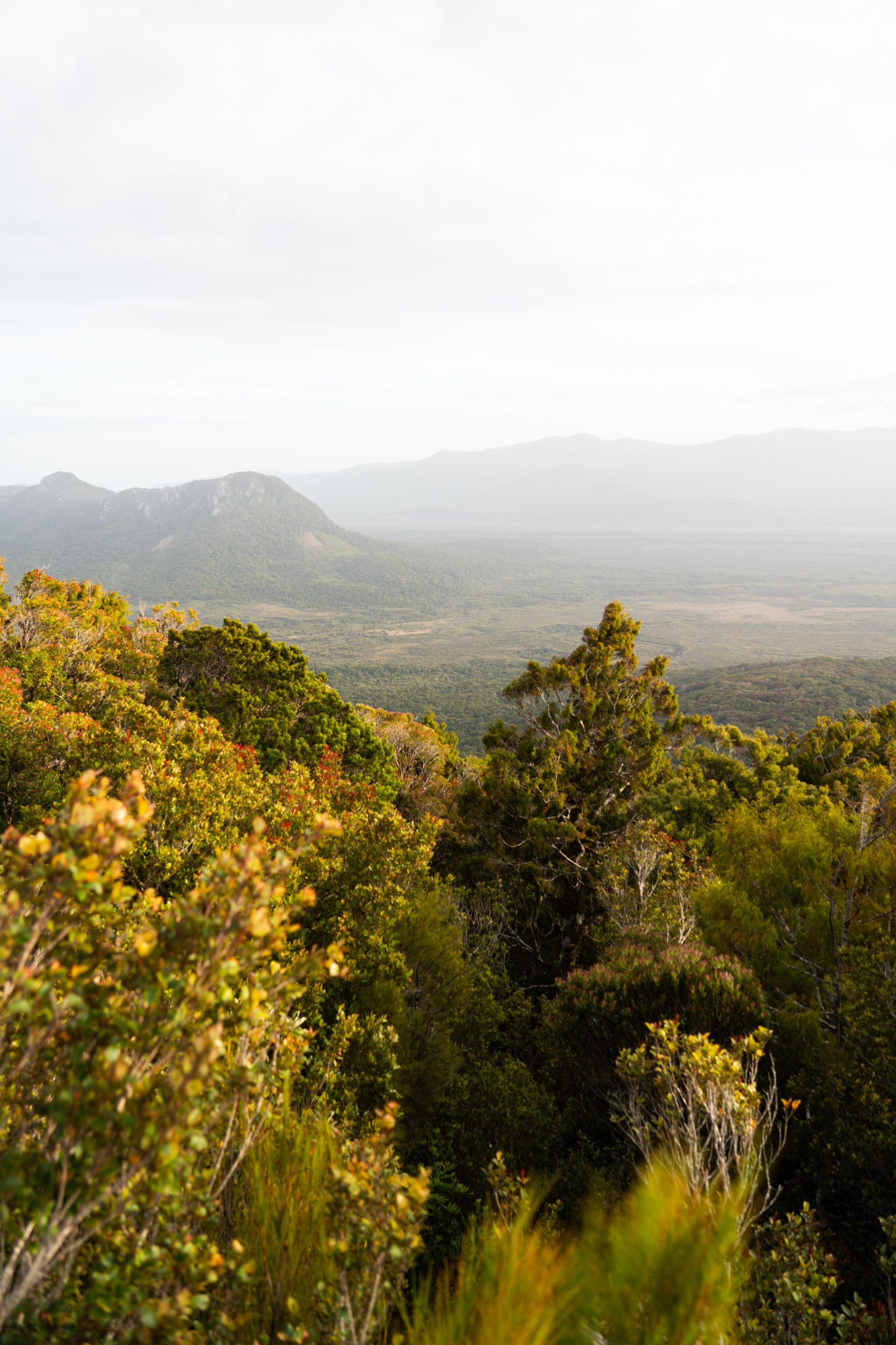
Once at Port William (9.45am) I officially started walking the North West Circuit. The entire track follows the coast line, which means you have many beaches to cross, with (steeper) forrest sections in between.
The plan for this first day was reaching Christmas Village Hut, which seemed easily doable when I had done a few hours and soon shifted my plan to reach Lucky Beach Campsite. As I brought a tent with me, this was an option. If you don’t it would have made sense to stop the day at Christmas Village Hut.
While hiking to Lucky Beach Campsite, I crossed the section that would allow you to summit Mount Anglem / Hananui. I decided it wasn’t worth it, due to the low visibility. In hindsight I’m glad I did not do it, you have enough options during the hike to reach amazing viewpoints, that are simply on the track.
As soon as I reached Lucky Beach Campsite I was happy to have the bug spray, as I got swamped with sand flies. I quickly set up my tent, right next to the beach. Then jumped into the river that mouthed into the sea, which served as a nice shower.
After that it was time to sleep to the sounds of crashing waves…


+14
Hike
Download GPX
Day 2
Pretty amazing waking up and seeing so many sandflies. Not so amazing when you have to leave your tent.. Anyway, I packed it up quickly and started with the second day!
The plan for today was either to stop at Long Harry Hut or East Ruggedy Hut. The day would tell what it would end up being.
As would become normal during this hike, I started with a small beach section followed by climbing up through the forest until the next beach.
In this case ‘next’ meant Smoky Beach. Coming down to it I felt the wind had picked up and once waling along the beach it stated to rain. This was the first time I grabbed my rain pants and basically never took them off anymore, for the entire trip.
Fortunately, as is normal with New Zealand weather, the rain never stays on too long and it actually stopped once I had reached Long Harry Hut. Having lunch here made me decide I could push it to East Ruggedy Hut today.
Just before you reach East Ruggedy Hut, you have East Ruggedy Beach. And just before this one, you have an unnamed beach that was very rocky. Boulders which probably weighed up to a few hundred kilos. It was pretty amazing walking this section with the waves crashing into them. I stood there for a while and could have probably stayed there for much longer looking at the spectacle that unfolded in front of my eyes.
Having reach East Ruggedy Hut, I was pretty tired and happy I didn’t have to setup my tent tonight. I had diner and basically straight away snugged into my sleeping bag for a good night of sleep. Preparing myself for a big day tomorrow.


+5
Hike
Download GPX
Day 3
Last night when I reached East Ruggedy Hut, I was in doubt what to walk for this third day. Either I would stop at Big Hellfire Hut or make a big push all the way to Mason Bay Hut. Only one obstacle: when you walk over Mason Bay beach, you must have low tide if you want to avoid the high tide route (which adds an extra hour or two). Knowing the tidal times it was looking like I couldn’t reach this section in time for low tide. Anyway, I decided to just start early and make the call once I would reach Big Hellfire Hut to push on or stay.
Getting to Big Hellfire wasn’t all that difficult. It’s a pretty normal day on the North West Circuit. From East Ruggedy Hut you descent down through the forest to West Ruggedy Beach (which has a cool camp spot in a cove if you want). After this you climb up again to cross the Ruggedy Mountains before you make another descent, this time to Waituna Bay. Now you have one last climb to make and this brings you to Big Hellfire Hut.
When I arrived here it was 1pm. Exactly the time of the day that it would be low tide on Mason Bay Beach. But getting there would still take me a good 10km which I estimated would be around a 4 to 5 hour hike. With the knowledge there were not much campsites on the track, I decided it wasn’t worth the risk being stuck and I didn’t want to reach Mason Bay hut in the dark or backtrack all the way to Big Hellfire hut. I called it an early day for ones.
I actually didn’t mind, as I could recover well from the last few (big) days and enjoy the unique location of this hut. At 220m, this hut is definitely not ‘at sea level’. But for some weird reason, dunes have formed along the hut at this elevation. It might be because of its specific location in combination with the wind direction that has blown up all the sand over here. At least that’s what I was thinking when standing on top of those dunes with the wind blowing full into my face. It did give me an amazing sunset.


+11
Hike
Download GPX
Day 4
With a rested body, because of the early stop the day prior, I started day 4 full of energy. Being up early I calculated I would reach Mason Bay Beach at around 11am, which would be a good two hours before low tide. I thought, if the tide is still to high when I arrive, I can simply wait for it to get lower.
And so it happened. I started the section Big Hellfire Hut —> Mason Bay Beach. Good to know for this one is that it’s the only section on the track where you will not encounter any water sources, as you are walking up high in the ranges. Fortunately (to some extend) I had not the best weather. (Very) Windy, cloudy and around 13 degrees. That meant I wasn’t drinking too much and with just one flask I managed this section well. On a warm summer day I would recommend having an extra bottle, especially if you get stuck somewhere along this section.
I reached Mason Bay Beach at my projected time of 11am. When descending down to it I could see a big rock outcrop, which is the spot which you can only walk around at low tide. I hoped it would be doable by the time I would be there.
Setting the first steps on the beach (which was more like rocks at this end), I noticed one spot which could have been a good campsite. If I had known this, I would have made the push to Mason Bay the day prior and spent the night there, then waking up the next morning either taking my time to do the high tide route or wait for low tide.
Anyway, I was on the beach now and still a bit early for low tide, by about 1.5 hours. Being at the rock outcrop, I noticed I couldn’t simply walk along it. However, if I timed it right, at the moment the waves were pulled back, I thought I could sprint around it. So, I waited for some wave cycles to get a feeling and when I thought it was my time I started running! With the splashing of water I ran across it and right at the moment the waves started to hit me, I was in the safe zone on the other side of the rock outcrop. I won this one!
After this it was a flat multiple km (about 4 or so) of walking over the beach. I imagined how nice this could have been on a clear sunny day. While it was not raining, it still felt like that. I had a constant layer of sea spray on me because of strong westerly winds. It made it pretty eerie and mysterious walking here alone.
All alone I wasn’t anymore once I reached Mason Bay Hut. For the first time during the hike it felt I had reached a more accessible hut. The days prior I had always seen some people, but only a handful at the most. Here at Mason Bay there were at least two handful of people enjoying a dry time inside, while simultaneously new people arrived, fully soaked from the rain. I had a big lunch and decided to push on, through the poring rain, on to Fresh Water Hut.
This section, Mason Bay Hut —> Fresh Water Hut felt like a ‘walk in the park’. To give some perspective, Big Hellfire hut to Mason Bay Hut was 15km which took me 6 hours to complete. This second section of reaching Fresh Water Hut was also 15km, but only took me 3 hours!
Being here I was glad to take off my soaking clothes, prepare diner and light a warm fire. Later in the evening an American couple joined me in the hut and we shared some good hiking stories.


+24
Hike
Download GPX
Day 5 + Tips
The last and final day. Mentally this one is always easy. You know you are almost there and you can eat as much as you want. No need to ration your food anymore!
Physically there was still a bit of challenge. Which I could have actually avoided by taking a water taxi back to Oban, from Fresh Water Hut (which many people do). I decided not too and took on the big climb head on. I’m not talking about reaching the peak of Rocky Mountain (again because I had seen the views and was not excited to climb this in the pouring rain) Instead I followed the track which climbs steeply towards North Arm Bay. Going up and down here I think I didn’t manage much more than 2km/h. The mud, in combination with the elevation, made it for such slow hiking, I almost walked backwards..! It was another confirmation I was happy to have brought my hiking poles as I probably would have not gone far that day without them..
To summarise what happened once I reached North Arm Hut: I had lunch and walked back over the track which was now part of The Great Walks (New Zealand’s top notch maintained tracks) making me fly. Before I knew it I was back in Oban, could enjoy a cold soda and have a long warm shower in my hostel.
I had completed the North West Circuit on Stewart Island / Rakiura!


+10